
Presentation
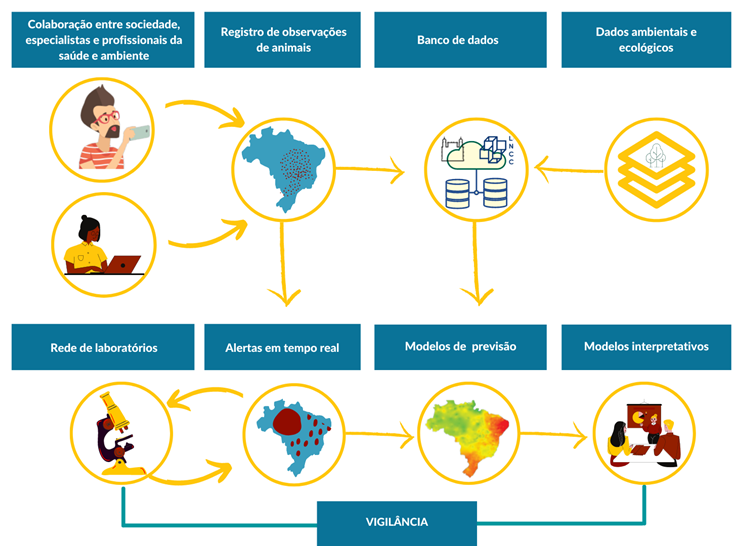
SISS-Geo is a citizen science tool, built on the precepts of One Health. It is free, works "offline" to be useful and avoid data loss in remote locations. The georeferencing of images and animal records allows for correlations between databases of land-use changes, disasters, and climate change. The simultaneous distribution of alerts to the three levels of government regarding abnormalities in dead and sick animals generates rapid mobilization of field teams for investigation and collection of biological samples to be analyzed in the laboratory and for immediate measures, if necessary. Thus, the collaboration of an ordinary person with a cell phone in hand who finds an animal in nature, in urban or rural areas, activates the entire SUS surveillance system, providing speed, efficiency, resource savings, and data quality for decision-making.
Objectives:
- To generate, from georeferenced records provided by users, alert models for wildlife health events, especially those with the potential for human impact, and prediction models for ecological opportunities for disease emergence.
- To provide, quickly and efficiently, the flow of information between CISS; the Participatory Wildlife Health Network and the Wildlife Laboratory Network; society, through citizen science; and government sectors and decision-makers.
- To make information about modeling results available to the community, decision-makers, and society.
- To integrate with georeferenced government platforms, especially the Brazilian Biodiversity Information System (SIBBr) and the INDE Platform, with a Metadata standard.